

Boston, MA - June 27, 2018 - (Newswire.com)
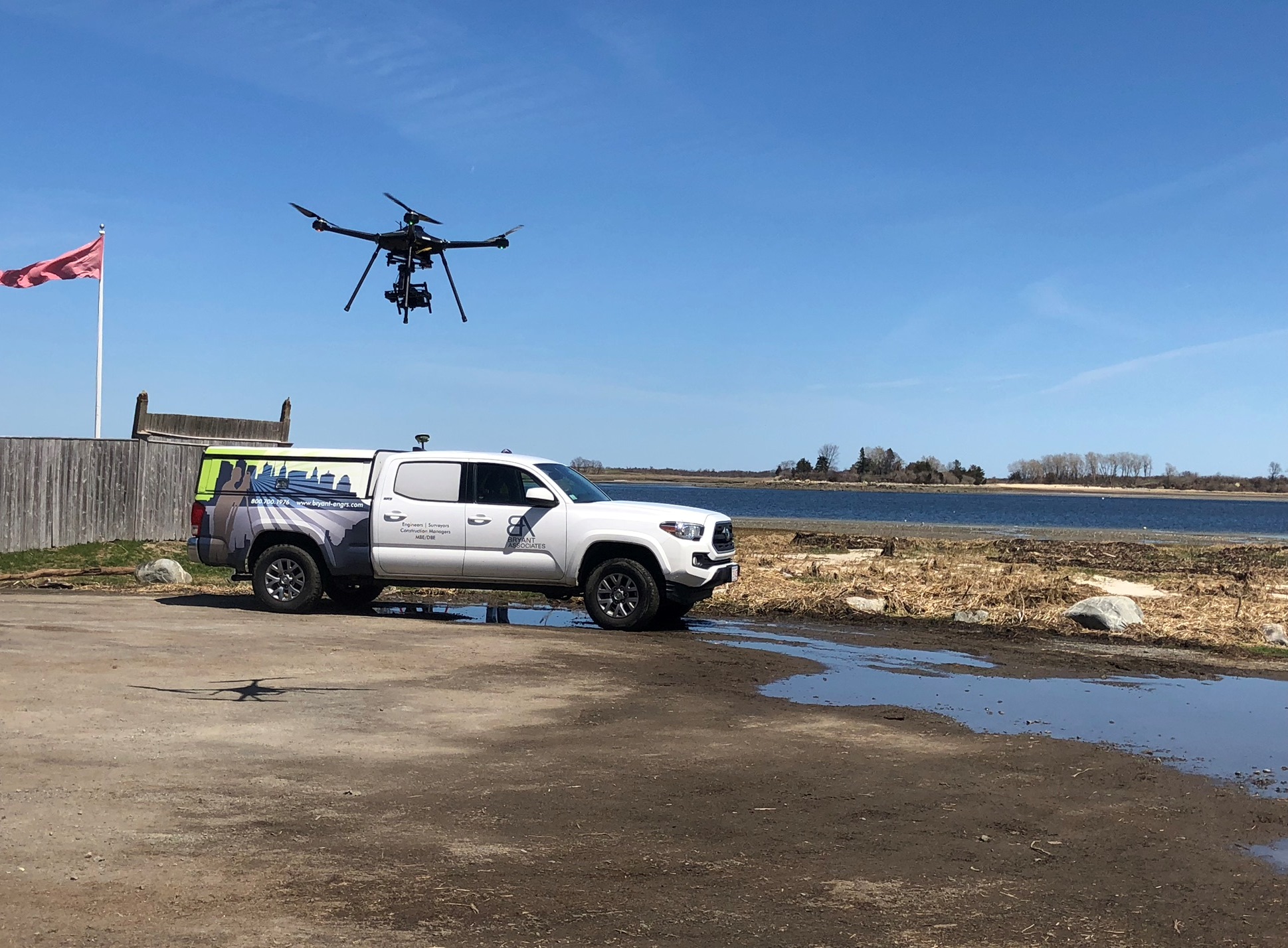
Bryant Associates Inc. (Bryant), is pleased to announce its new mapping/photogrammetry capabilities via drone. Bryant recently added an Unmanned Aerial Vehicle (UAV aka drone) to its inventory of survey equipment and is integrating UAV capabilities with its other survey technologies, including conventional ground survey, RTK GPS and terrestrial LiDAR scanning.
“Bryant has always prided itself on being an innovative leader in the engineering and survey industry. The addition of the drone to our inventory of survey equipment continues this practice and gives us a way to expand our service capabilities while bringing added value to our client’s projects.” says Jeffrey Bryant, PE, CEO of Bryant Associates, Inc.
Bryant’s mapping and photogrammetry process by drone begins with the development of a flight plan by an FAA Part 107 certified pilot and our professional land surveying team. The pre-determined flight plan is then followed and data and photography is captured. The data is processed and analyzed and quality control checks are made to ensure required accuracies are met and deliverables are fulfilled.
As specified by clients, Bryant can provide deliverables including:
- RTK centimeter-level precise mapping and photogrammetry in numerous CAD formats
- Supplement ground data of features not captured in aerial photos
- Overlay property lines, critical design features and construction features on photos
- Detailed image-based plan by geo-referencing aerial images Topographic plans representing contours and elevations of ground features
“Not only does the drone allow for the collection of additional data for clients so they can perform deeper analysis on their projects and make more informed decisions, but performing aerial mapping and photogrammetry by drone is efficient and it minimizes risks to both our staff and the general public.” adds Gary Hamilton, Director of Corporate Survey.
Bryant’s custom-built Eagle XF UAV quadcopter from UAV America features a survey grade RTK, a 3 axis gimbal, a Sony A7R camera with 12MM aspherical II lens, FPV camera, 4K HDMI monitor/recorder, and anti-collision sensor and is FAA approved.
For more information about Bryant’s survey and mapping capabilities by drone, visit http://www.bryant-engrs.com/AboutUs/UAVDroneServices.aspx
About Bryant Associates, Inc.
Founded in 1976, Bryant Associates, Inc. (Bryant) is an MBE/DBE professional consulting firm that provides civil, structural and traffic engineering, water resources, construction management and surveying services to public and private clients throughout the Northeast, Midwest and Mid-Atlantic regions. The company is headquartered in Boston, MA with offices in Rocky Hill, CT; Baltimore and Landover, MD; Lincoln, RI and Louisville, KY. For more information please visit bryant-engrs.com or follow us on Twitter @BryantEngineers
About UAV-America
UAV-America was created to deliver quality aerial platforms with "ready to fly" capability for aerial imaging. As a veteran-owned business, it provides UAVs (unmanned aerial vehicles) for infrastructure inspection, surveying and mapping, precision agriculture, cinematography and multiple other applications. UAV-America places superior customer service and support as its top priority, working directly with clients to design specific solutions to their needs. Using its experience in the industry, UAV-America now raises the bar to provide custom and off the shelf solutions in a flexible platform. To contact UAV-America, call 603-389-6364, or email info@uavamerica.com.
Related Files
BAI Drone Flyer.pdf
Press Release Service by Newswire.com
Original Source: Bryant Associates, Inc. Announces New Drone Mapping/Photogrammetry Capabilities
